 Print-Friendly Version Print-Friendly Version
|
|
Duncan Ridge to Wallalah Mountain via Coosa Bald | |||||||
| The Basics: | |||||||
| Event Type: | Hike | ||||||
| Event Location: |
Vogel State Park


| ||||||
| Date(s) & Time: | Sat, Jan 31 2015 8:00 am >> Sat, Jan 31 2015 8:00 pm (Carpool Departure: 6:00 am *log in for location*) | ||||||
| Registration Opens: | Mon, Jan 12 2015 8:00 pm | ||||||
| Registration Cut Off: | Thu, Jan 29 2015 11:59 pm | ||||||
| Event Duration: | 12 Hours | ||||||
| Difficulty Rating: | D7: Extreme (Exploratory) | ||||||
| Distance: | 26.5 Miles | ||||||
| Pace: | Fast | ||||||
| Trip Leader(s): | Bill Eric P  Email Trip Leader(s) Email Trip Leader(s)
You must be logged in to get the Trip Leader contact information. | ||||||
| Member Cost: | None | ||||||
| Participant Info: | |||||||
| Who's Invited: | Members Only, 21 And Older Only | ||||||
| Maximum Group Size: | 8 | ||||||
| Minimum Group Size: | 4 | ||||||
| Number Registered So Far: | 11 / 0 (To see who's signed up, log in to the Member Area) | ||||||
| Are Dogs Permitted: | No | ||||||
|
Note: This is an "EXPLORATORY" trip. This means that there are parts of this trip, or perhaps the whole trip, that is new to your Trip Leader(s). However, they are confident that this will not be an issue. This note is here so that you can make an informed decision. When a Trip Leader isn't personally familiar with a trip, there is an increased chance of things not going as planned and you need to be prepared. The Trip Leader may have additional details in the itinerary. | |||||||
| Itinerary: | |||||||
**The Event ended up being 26.5 miles with 8,050 ft of ascent. Additionally the out and back to Skeenah gap was removed**
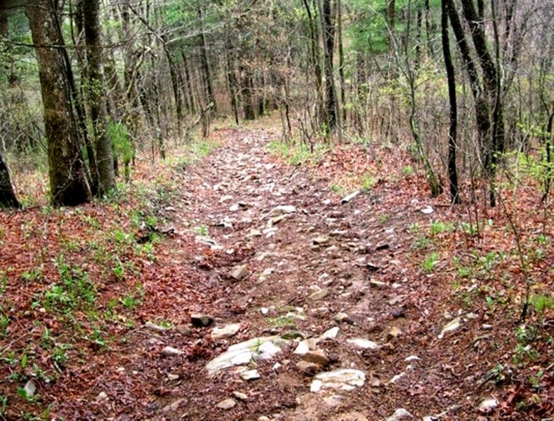
Join me for an AOC first, a Day hike across the Duncan Ridge Trail (DRT). This is a shuttle hike that sets up for a very long day, with lots of miles with continuous up and downs. We will hike 21+ miles and climb a lot. How much? A lot, maybe 5,000 feet or much more. I'll let you know when we're done The plan is start at Vogel State park and begin our journey counter clockwise on the Coosa loop. We will climb up and over Frady Mountain as we head to Coosa Bald. Just south of Coosa Bald we will intersect the DRT (Duncan Ridge Trail). A right onto the DRT takes us to the top of Coosa Bald (4,270 ft), which is an infrequent visit by the AOC. From there we drop down to White Oak Stomp (3,460 ft) then a walk over to Buckeye Knob (3,820 ft) before a long drop into Buckeye Gap (3,280 ft), then Byrant Gap (3,250 ft). A sharp climb out of Byrant Gap up to Buck Knob (3,460 ft), then a short climb to West Wildcat Knob (3,500 ft). From Wildcat we head down to Mulky Gap (2,780 ft). From Mulky Gap we head up to Atkin Mountain (3,530 ft), then into a gap before a short steep climb up Clements Mountain (3,500 ft). Dropping into Atkin Gap we then climb to the top of Fish Knob then dropping to Fish Gap (3,100 ft). A gradual climb out of Fish Gap (3,320 ft) then straight down to Sarvis Gap (3,020). Next up a series of climbs Payne Knob (3,4020 ft), Gregory Knob (3,360 ft), and Rhodes Mountain (3,380 ft). At Rhodes Mountain we take a small detour and do an out and back to Skeenah Gap. Back at Rhodes we descend to Licklog Gap. Our final long climb up to Walhalla completes our elevation gain for the day. We descend Walhalla to Rte 60 to complete our journey.
This is a very long strenuous day of hiking. Due to the distance and climbs we may be hiking a number of miles in the dark. Be prepared with a headlamp or flash light. The trip leader reserves the right to remove anyone from the list they feel can not complete this hike. You must be a "team" player. if the trip leader feels this is not your style of hiking you may be removed from the list. If the trip leader has not hiked with you in the past, you may be removed from this hike. This is a shuttle hike. Drivers will be determined prior to the trip date. When you sign up please note if you are willing to drive. If there is a wait list and you are not willing to drive and we need a car you may be bumped for somone willing to take their car. For the safety of the group I need to adhere to the above comments. | |||||||
| |||||||
| How to Get There: | |||||||
| Carpool to Event Distance (round trip): | 220Mile(s) | ||||||
| Carpool Departure Time: | 6:00 am | ||||||
| Carpool Location: | Log in for location | ||||||
| Carpool Directions: | Log in for directions | ||||||
| Carpool Cost: | Estimated cost per vehicle for this event is $88.00 using a reimbursement rate guideline of $0.400 per mile. The total amount should be divided by the number of people in the vehicle, including the driver. This is a guideline, not a rule, for drivers but the cost should not be higher unless there are extenuating circumstances. | ||||||
| Notes: | |||||||
|
* We encourage all members to follow our Etiquette Guidelines while participating in AOC events. | |||||||
Cancellation/Partial Attendance: Please review the AOC cancellation policy. *Note: Due to the difficulty and length of this trip if we have inclemnt weather this trip will be cancelled. | |||||||
 Calendar of Events
 Event Places