Sat, Sep 6 2008 - MAP & COMPASS HIKE and PICNIC by the HOOCH (View Original Event Details)
| Trip Leader(s): |  |
Charlie Cottingham, Paula Schubert, Tom Collins
|
| Participants: | | Tom Collins, Charlie Cottingham, Paula Schubert, Pete C., Christopher Bolton, Lisa Maldonado, Hilke Neuerburg, David Bennett, Jim H, Tony C, Laura, cliff j, Tian, Denise T, April, Eric Burgess, Erica, Sharon S, Julie, Thomas Melton, Adam Taylor, Tom Jarosz, Pam Irwin, Ali Zadeh, Angie Rowe, Susan Cooper, Melanie Dixon, Pam, Sue Jones |
| 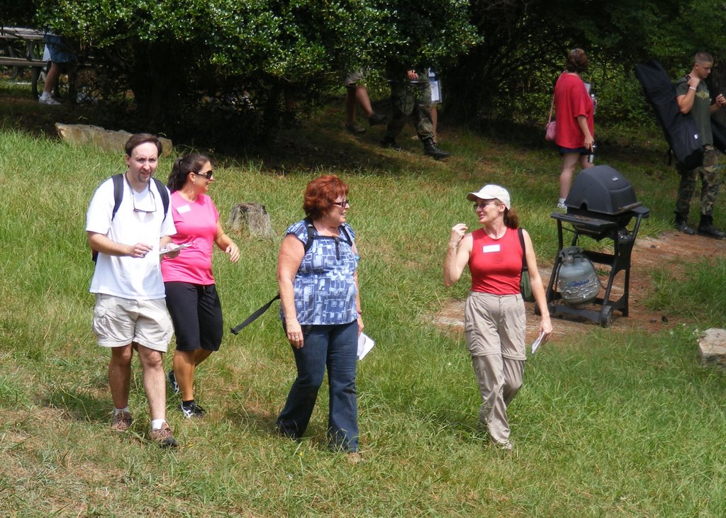 |
Write Up:An adventurous and friendly group of 29 AOCers had a good time together on Sat. Sep 6 helping the Georgia Orienteering Club (GAOC) celebrate “National Orienteering Day” in the Jones Bridge Unit of the Chattahoochee River Nat’l Rec. Area. Thanks to Paula Schubert for getting some nice snapshots -- to view them, go to her PicasaWeb album at:
http://picasaweb.google.com/pjsoutherngal24/9608AOCMapsAndCompassOrienteering
This big annual O meet is one of about 20 meets that the GAOC organizes each year for their members, other invited groups, and the public at large in beautiful wild areas throughout Metro Atlanta and North GA. Our heartfelt thanks go to the hardworking GAOC volunteers who provided (at no charge) registration for our “map & compass wayfaring hikes,” full-color topo "O maps" of the Jones Bridge unit and a delicious free hotdog cookout afterward. We were actually among about 300 orienteering enthusiasts, young and old, who participated in this big O Day event, and were blessed to have great early fall weather -- with the remnants of Hurricane Gustav fading to our west and Tropical Storm Hanna roaring up the Atlantic seaboard far to our east.
We gathered at 9:45AM in the GAOC’s registration area at the sprawling CRNRA Special Events building. After introducing one another and registering for the meet, we spent the next few minutes in monklike fashion transcribing little red circles and numbers from “master maps” of the Yellow and “Score-O” courses to our thirty or more copies of the Jones Bridge O map. The quarter-inch red circles on the map indicate where bright orange & white “control flags” are hung in in the actual terrain, and we were also given “clue sheets” which indicate what to look for in the vicinity of each slightly hidden control: e.g. a stream intersection, boulder pile, large overturned tree, bridge, etc. Our main objective would be to find all eight controls on the Yellow (advanced beginner) course -- also if we had a little energy left, the plan would be to look for a few of the 22 “Score-O” controls which vary in how difficult they are to find, and award more “points” for the harder ones. When we reach each control, we can prove that we’ve been there by punching our registration card with a uniquely patterned punch that hangs from the control marker -- also called a "flag" or "bag."
Between about 10:15 and 10:45 my co-leaders Tom Collins, Paula Schubert and I (Charlie Cottingham) hosted for our AOCers a tutorial in the basics of the sport of Orienteering and a refresher in fundamental map & compass skills. Several “loaner” compasses were available for those who didn't bring one and the spacious upper deck of the CRNRA’s Special Events building was an ideal place for our little "seminar" with its tables & chairs and ceiling fans! The main thing we stressed about the compass is its usefulness for “orienting the map to the terrain” by rotating the map underneath the compass so the north-pointing compass needle is parallel with the black magnetic-north guidelines on the map.
At about 11:00 AM, after dividing into three teams of about ten each, we set out to try our hand at what we’d just discussed. We turned in our registration forms and waivers in the GAOC Start Area and were assigned staggered start times to set out on the Yellow course and find its eight controls in the proper sequence. While out on the course, each of our groups stopped often to discuss where we were on the map, to brainstorm strategies for “attacking”the next sequential control, and to take turns leading the way toward a control -- then punching our card once we found it. While out on the course we often encountered other parties and individual "orienteers" who were passing us in all directions at various speeds, but as planned, we stuck to our relaxed “wayfaring” pace rather than competing for a fast time. By about 12:45 all three of our AOC teams had proudly succeeded in finding all eight controls on the ~2-mile Yellow course and were back safe and sound at the Special Events building where we had started. Many of us stuck around for the leisurely “social hour” and hotdog cookout afterward. My friend and “master hotdog chef” Steve Shannonhouse served up a total of more than 400 “O Day” dogs compliments of the GAOC.
We recognize that proficiency in using maps & compasses can enhance our enjoyment of the outdoors and afford us more safety, confidence and versatility -- for example, when having to select a route for an emergency evacuation. We look forward to having more AOC orienteering events in the future in which we can practice our map & compass skills while navigating through unfamiliar wilderness terrain. As Paula suggests, we could also have some fun by competing for speed as AOC teams or individuals! Two great locations for this are Red Top Mountain State Park and Sweetwater Creek State Park where GAOC volunteers have set permanent orienteering courses -- allowing us to plan “O events” in those parks at any time we please -- each of those O courses is only about a 30-minute drive from Atlanta. The GAOC’s excellent website by the way is: GAOrienteering.org.
Thanks again to my good friends in the GAOC -- also to Tom Collins and Paula Schubert, my excellent AOC co-leaders without whose help it would’ve been impossible to expand our numbers for this popular event -- also to Chris Bolton who expertly supervised our group’s waiver-signing process.
--Charlie Cottingham, Sep. 8, 2008
 Calendar of Events
 Event Places