Fri, Oct 2 2009, Sat, Oct 3 2009, Sun, Oct 4 2009 - Shining Rock, NC High Country Fall Color Weekend (View Original Event Details)
|  |
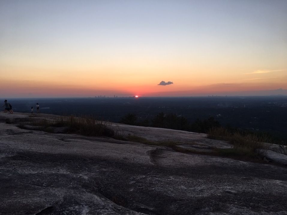
As the forecast had predicted, the weather was nice from late Friday through the rest of the weekend. We had to endure a little drizzle Friday afternoon (about 0.1 inch) but it had cleared completely by dusk Friday. A beautiful full moon and stars were up all night both Fri and Sat nights and the skies were azure blue all day Saturday.
En route up Friday morning in our carpool caravan (my Civic and Rene's sedan) we enjoyed the scenery through Clayton, Highlands & Cashiers. At Brian's suggestion broke up the trip with a nice 2-mile, 1-hour scenic loop hike up and around the craggy top of Whiteside Mountain, 5 mi E of Highlands. Although we'd already had a "brunch" at the Burger King in Clayton we couldn't resist a second request from Brian: the Carolina Smokehouse in Cashiers where we pigged out on a hearty BBQ and homemade cobbler lunch.
At about 2PM we arrived at the main Shining Rock parking lot & trailhead at 5800' elevation, about a mile NE of Blue Ridge Pkwy milepost #420 via FS Rd 816. Due to foggy skies and a little drizzle we chose to backpack in via the flat and wide Ivestor Gap Trail, a 4-mile continuation of FS-816 that was apparently once an old railroad bed for loggers. By about 4:30 we had arrived at the "Shining Rock Gap" trail junction and found a cozy wooded campsite with a few level spots for tents about a minute away from the Shining Rock Gap spring, a great water source! Spent both nights there just a few feet downhill of the Art Loeb Trail. The site was heavily wooded, with several trees suitable for hanging mine and Brian's hammocks and a few high limbs suitable for suspending our food bags safely away from bears.
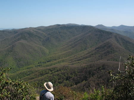
After breakfast Saturday we took a beautiful 10-mile round-trip dayhike with many stops for photography, relaxation, and chatting with the many other interesting hikers and backpackers we met along the way who were from all over the Southeast. We began the trek by first hiking northeastward from our campsite to the huge white-quartz Shining Rocks, then westward to the Art Loeb Trail and northward to Cold Mountain. This worked out perfectly for 10AM-6PM Saturday, with fabulous views of the whole wilderness from the rocky outcrops at the 6000' end of the trail atop Cold Mtn. Amazingly, the blueberries were still plentiful and sweet and the oval blueberry leaves a beautiful crimson -- we ate our fill all around the Shining Rocks Sat and in other spots en route to & from Cold Mtn (and again on Sun en route back to the cars).
As I had recalled from previous trips to the Shining Rock Wilderness: There's practically no signage at any of the trail junctions and the topo maps fail to show the numerous "spurious" trails that branch off the marked trails in many places. On Saturday morning en route from the gleaming white Shining Rocks to Cold Mountain, we took a trail that headed in the right NW direction and was wide and well traveled at first but petered out to nothing and became steep in a few spots as we descended. Realizing from the topo map that we had to be close to the Art Loeb trail we chose to continue bushwhacking down the hill westward, and were relieved when we connected with the Art Loeb about a half mile north of Shining Rock Gap.
After breaking camp Sunday morning we took the Art Loeb Trail southward from near Shining Rock Gap to the summits of Flower Knob and Grassy Cove Top and continued on what we thought was the Art Loeb -- but soon realized that once more we'd gotten temporarily onto a spurious trail. We could easily see all the campers and 4-wheelers in the open gap below and made it down that narrow trail (which we discovered was a bit east of the "true Art Loeb") without much difficulty. When we reached the base of Grassy Cove Top (about 0.2 mile south of its summit) we made a right turn in the road, reaching our target Ivestor Gap junction in about 100 yards. We discovered that the true Art Loeb from the top of Grassy Cove Top meets the Graveyard Ridge Trail about 50 yards east of that main trail junction (marked by a big boulder or two) at Ivestor Gap. [For future reference: At Ivestor Gap we encountered several campers & hikers with their high-clearance or 4WD vehicles, so apparently it's legal to drive from the main Parking Lot up the Ivestor Gap roadway ~1.6 mi north to that point -- this fact that might come in handy sometime in the future if a backpacking group happens to be running late.]
Continuing south on Sunday from Ivestor Gap via the Art Loeb Trail (actually marked there! for a change) we arrived after 0.1 mile at the junction with a very short trail that connects westward to the Ivestor Gap Trail. At that point Kim, Irina and Rene decided they'd take that flatter route back to the cars, but Brian and I continued on the Art Loeb up and over the extremely scenic summits of Tennent Mtn and Black Balsam Knob -- then met them at the cars after hiking down the Art Loeb Spur trail that turns west off the knob just S of the Black Balsam summit. That Spur Trail meets the Ivestor Gap Trail just a few feet north of the Parking Lot at the end of FS-816.
Sunday afternoon we caravanned Sun back to Atlanta via Looking Glass Falls, Brevard, Whitewater Falls, SC-11 and I-85. There's a fantastic (all-you-can-eat for $9.00) Asian buffet, "Twin Dragons," on the main US-276 hwy in the middle of Brevard that we took good advantage of Sunday afternoon. Ate ourselves silly for about an hour and a half.
Thanks to our friend Tony Ciccarello for his superb help in planning the trip -- sorry Tony couldn't join us this time.
 Calendar of Events
 Event Places