Sat, Apr 14 2012 - ^^ Summit GA�s Highest Peaks: #3 - Hightower Bald (4568�) ^^ (View Original Event Details)
| Trip Leader(s): |  |
Mark
|
| Participants: | | Mark, micheal, Rick C, Linda F, Mark P, Mike, Sherif H |
| 
Click for Album |
Write Up:Although Clint Eastwood and Justin Timberlake attempted to get this hike off to a slow start we managed to hit the woods only about a half hour behind schedule. (explanation later)
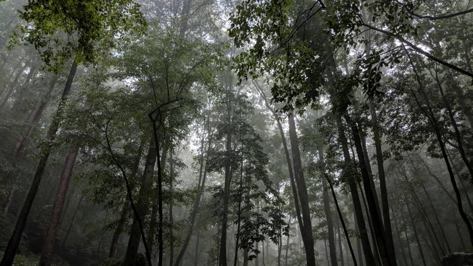
After arriving at our parking spot, we grouped together at the starting location, had a short safety briefing, and then headed off into the forest just before 11:00AM. The first 3/4 mile of the hike was a relatively gradual ascent along the pleasantly gurgling, clear, Shoal Branch mountain stream. Shortly thereafter, we headed west until we arrived at the first BAH - an acronym for a technical term defining a geographical feature with a very steep incline. So up we went... navigating around and along stream ravines, downed trees, climbing over rocks, maintaining balance by holding whatever objects didn't move, until we ascended 800 feet in 3 tenths of a mile. After taking a brief reprise in Eller Gap we continued on the next half mile with a relatively mild 200 foot ascent before arriving at the base of the next BAH where we ate lunch on a rock outcropping while looking at our goal off in the distance. And then it was on with the leather gloves to tackle the next BAH. Although slightly shorter, this BAH required 4AD (that's 4 appendage drive) as we had to ascend another 550 feet in just 2 tenths of a mile while crawling through mountain laurel tunnels. But when we arrived at the top of Shooting Creek Bald (4,300 ft) we were rewarded with a cool breeze, bright blue skies, and some mostly unobstructed views to the south.
From Shooting Creek Bald we headed over to the formerly unnamed 4,400 foot peak (presently called AOC Peak) that sits between Shooting Creek Bald and Hightower. Near the top of AOC Peak there is a rock outcrop at the top of some huge cliffs that provided us with clear unobstructed views where we could see Hightower with its high cliffs, Rabun Bald, and other mountains to the east and south. After leaving AOC Peak we just had a short hike of less than a half mile along a knife-edge ridge, through a small gap, and then up a few hundred more feet to the top of Hightower. Once we arrived at Hightower Bald's 4,588 foot high peak, we took a short break for some photos, and then we all decided as a group that we wanted to visit Montgomery Corner, which has a very unique and interesting history in the boundary definition between GA and NC. So we descended a few hundred feet down to Montgomery Corner, took some more photos, signed the geocache logbook, and then headed back up for our second summit of Hightower for the day.
Up to the top of Hightower from the start, we had ascended 2,600 feet in roughly 3 miles. However, considering there are no trails to follow, every step was on terrain that shifted, slid, or rolled, and 1,800 feet of that ascent occurred in a half mile of travel, this event might have more appropriately been classified as an outdoor climb than a hike.
Well it's all downhill from here; right? Yes, it was all geographically downhill from here; but by no means was the remaining journey to be easy or anticlimactic. We still had a rock outcropping at the top of a cliff to get to, another really BAH to descend, and a formerly unnamed waterfall to visit. So we descended about 350 feet in elevation and with a bit of scrambling up and down through thick mountain laurel finally found the top of the cliff for which we were searching. From this spot, on this sunny clear day, we had an absolutely beautiful view all the way from the south to the west. We were able to see Brasstown Bald and its tower, Tray Mtn, Horsetrough Mtn, Double Spring Knob, Eagle Mtn, and many more peaks that were probably in the "highest peak" series but weren't able to identify. After a few ventured out on the rock outcrop for some Yonah-like poses, we continued down the BAH. First through thick mountain laurel which was a mixed blessing - it was tough to navigate, but also provided some reassurance by giving us something to grab onto, or crash into, to break our butt-sliding falls.
This is about the time when we first noticed the very strong gamy odor of bear. But we continued down, and down, and down, over, around, and below the cliffs until getting to the rhododendron thickets which began along the plummeting creek above the falls. And that's where we heard it - first a howling sound. Was it two trees rubbing together in the breeze? Then a blowing sound of expelling air... was it a buck? We stopped and listened - more howling sounds... definitely not a buck. And the howling and blowing sounds were clearly getting closer, so it was definitely not two trees - unless trees walk. Well, at this point we knew we had stumbled across a black bear. But where was it? All we knew was it was getting closer to us and the rhododendron was so thick we couldn't see through it more than about 20 feet. We huddled, went over the "what to do's" and "what not to do's" when a bear is approaching, and proceeded down the hill slowly. Seven people traipsing downhill through dry leaves and tumbling rocks had to sound like an elephant, which was good for us. The howling sound kept getting closer and closer until we could tell that it was no more than 20 yards away in the thick rhododendron. The howling and blowing noises continued, but it became clear that we were moving downhill and the bear was moving uphill, so we had a sigh of relief. After we skirted around and below waterfall it was obvious what had occurred. There were cliffs on the opposite side of the rhododendron, there was a 30-foot waterfall below where we had been heading, and the bear had no choice but to go uphill through the rhododendron right past us. And the bear was giving us a stern warning; "I'm here, and don't come over and ___ with me." (The first two videos on this website are the exact two sounds that the bear was making
http://larrywbrown.blogspot.com/2010/11/sounds-that-black-bears-make.html . Evidently this is called "bawling" rather than howling as we had described it) So, after arriving at the base of the falls, Linda had the suggestion that we name the waterfall "Howling Bear Falls." Although now that we know the proper terminology, it will officially be called "Bawling Bear Falls."
After leaving the falls, it was another ¼ mile of precarious downhill travel before leveling off. And then the last portion of the hike was primarily a gradual descent following the pleasing sounds of Shoal Branch creek through a mix of rhododendron and hardwood forest where we also came across a beautiful flaming azalea.
After arriving back at the cars we were pleasantly tired, bleeding (some more than others), bruised, but extremely satisfied with the exciting and strenuous journey. The hike/climb had all the elements of a D6 - exceptionally steep inclines, difficult hiking, a Wilderness Area, no trails, bushwhacking, bloodshed, bruises, briers, bear, butt-sliding, crawling, scrambling, awesome vistas, clear mountain streams, springs, a waterfall, and the 3rd highest peak in Georgia... all and all, a very memorable experience.
Now to explain the interference by Clint Eastwood and Justin Timberlake... Seems they chose a church and one other location near Upper Hightower Rd to film a movie at our meeting spot where the group was to convene and drive to the hike parking location. And as if they were some sort of VIP's or something, the local authorities decided it prudent to block off roads, redirect traffic, prevent us from meeting at "our" location, and basically just creating a headache for us at the beginning and end of our hike. Well I asked to speak to Clint in an attempt to clear things up, but was told that he was ‘preoccupied.' I have since sent him a letter to inform him of the delay he caused, and am fairly certain I will receive a phone call any day now with a personal apology to our group.
 Calendar of Events
 Event Places